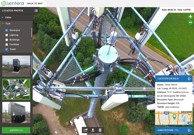
This view of a cell tower from one of Sentera’s drones shows the type of information-gathering the OnTop system enables. Image credit: Sentera
Canadian broadband company Gap Wireless has added a fleet of Sentera LCC drones to its inventory. These will be able to obtain information by capturing images from the air, and then feeding it into Sentera’s big data platform, OnTop.
The OnTop platform allows clients to use a mobile app and desktop client to identify the location, date, time, and asset type of every photo taken by the UAVs. Along with Sentera’s sensors and drones, Gap Wireless will also use other industry-supported UAV models to conduct cell and broadcast antenna site inspections.
This will ideally allow infrastructure inspection to proceed more quickly and more safely.
“Our advanced software solution fills an essential industry need to effortlessly collect and manage thousands of critical asset images,” said Greg Emerick, EVP of business development at Sentera. “Everyone in the value stream can quickly benefit from having access to highly organized, searchable, shareable, and contextually relevant inspection photos anytime, anywhere.”
The OnTop Platform includes the ability to do historical analysis of sites, tower inspections, equipment audits, and makes all images taggable and searchable, enabling them to be shared with teams and clients. The information is secured in a 256-bit AES + SSL encrypted cloud server.
“Gap Wireless is pleased to distribute leading-edge technology from Sentera that enables the broadcast and cellular industry to adopt safer inspection processes deploying UAVs in challenging environments, and also maximizes the value of captured images using cloud-based big data management,” said Glenn Poulos, VP and general manager at Gap Wireless.
The new Sentera products in Gap Wireless’ retinue were displayed at the Canadian Wireless Trade Show on Oct. 28 – 29.
Filed Under: Infrastructure