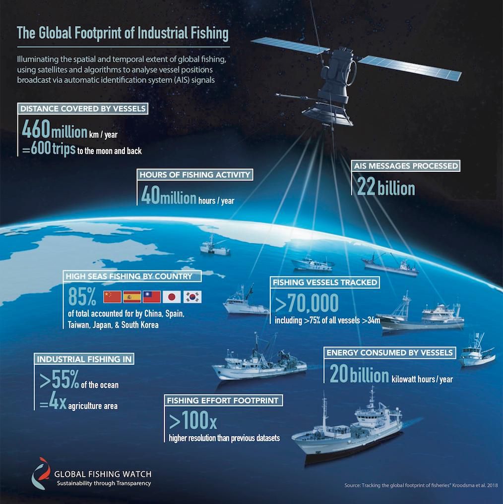
Industrial fishing data is important to keep track of for reasons ranging from where vessels go, when, and how they fish, to how many of these ships can be out at a given time and the amount of energy they consume. In the past, researchers have relied on data from logbooks, observations at fishing ports, and electronic vessel tracking, methods that ultimately paint an incomplete global picture of industrial fishing. Nowadays, researchers have begun utilizing a more accurate, impartial, and innovative technology to accumulate and organize industrial fishing data—satellites.
Many fishing vessels are being required to carry automatic identification systems (AIS). Originally intended to avoid collisions, the AIS releases data on details of the vessel like its location, identity, speed, and turning angle to satellite and land-based receivers. The additional data provided by satellites, along with its accuracy and overall quality, has provided essential information to researchers that their prior methods didn’t track, and is helping paint an intricate picture on the mechanics behind this important industry. The infographic below looks at the different types of data satellites collect on industrial fishing vessels, along with the figures that scientists have recently calculated for important categories.
(Image Credit: smithsonianmag.com)
Filed Under: Aerospace + defense


