Design World

  • Home
  • Technologies
    • 3D CAD
    • Electronics • electrical
    • Fastening & Joining
    • Factory automation
    • Linear Motion
    • Motion Control
    • Test & Measurement
    • Sensors
    • Fluid power
  • Learn
    • Ebooks / Tech Tips
    • Engineering Week
    • Future of Design Engineering
    • MC² Motion Control Classrooms
    • Podcasts
    • Videos
    • Webinars
  • LEAP AWARDS
  • Leadership
    • 2022 Voting
    • 2021 Winners
  • Design Guide Library
  • Resources
    • 3D Cad Models
      • PARTsolutions
      • TraceParts
    • Digital Issues
      • Design World
      • EE World
    • Women in Engineering
  • Supplier Listings

NASA Blasts off Space Laser Satellite to Track Ice Loss

By Phys.org | September 17, 2018

Share

(Image Source: Phys.org)

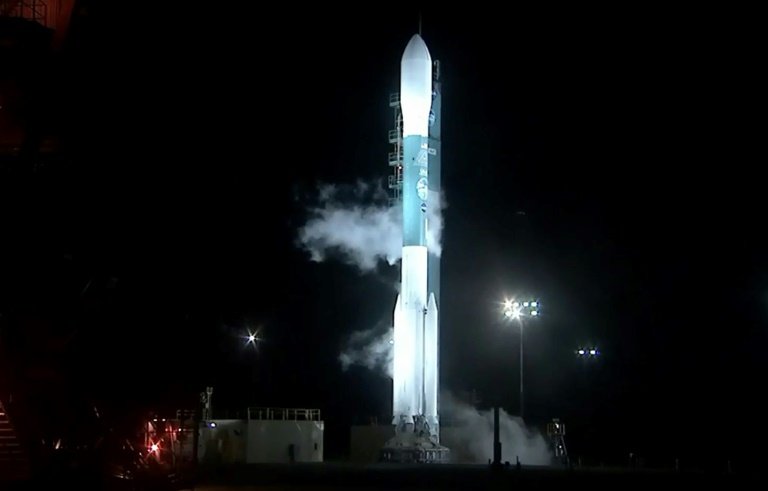
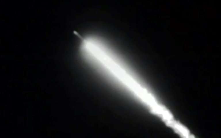
NASA’s most advanced space laser satellite blasted off Saturday on a mission to track ice loss around the world and improve forecasts of sea level rise as the climate warms.

Cloaked in pre-dawn darkness, the $1 billion, half-ton ICESat-2 launched aboard a Delta II rocket from Vandenberg Air Force base in California at 6:02 am (1302 GMT).

“Three, two one, liftoff!” said a launch commentator on NASA television.

“Lifting ICESat-2 on a quest to explore the polar ice sheets of our constantly changing home planet.”

The launch marks the first time in nearly a decade that NASA has had a tool in orbit to measure ice sheet surface elevation across the globe.

The preceding mission, ICESat, launched in 2003 and ended in 2009.

The first ICESat revealed that sea ice was thinning, and ice cover was disappearing from coastal areas in Greenland and Antarctica.

In the intervening nine years, an aircraft mission called Operation IceBridge, has flown over the Arctic and Antarctic, taking height measurements of the changing ice.

But a view from space—especially with the latest technology—should be far more precise.

An update is particularly urgent since global average temperatures have climbed year after year, with four of the hottest years in modern times all taking place from 2014-2017.

(Image Source: Phys.org)

“Loss of things like the sea ice that covers the Arctic ocean affects our weather, and loss of ice that covers Greenland and Antarctica raises sea level,” said Tom Wagner, cryosphere program scientist at NASA.

He added that the satellite should reveal new insights into the ice in the deep interior of Antarctica, which is area of mystery to scientists.
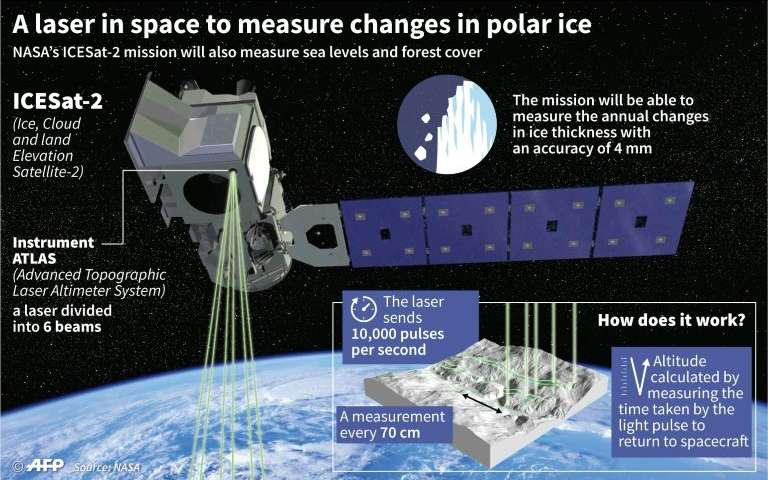
Potent laser

The new laser will fire 10,000 times in one second, compared to the original ICESat which fired 40 times a second.

Measurements will be taken every 2.3 feet (0.7 meters) along the satellite’s path.

“The mission will gather enough data to estimate the annual elevation change in the Greenland and Antarctic ice sheets even if it’s as slight as four millimeters – the width of a No. 2 pencil,” NASA said in a statement.

Importantly, the laser will measure the slope and height of the ice, not just the area it covers.

“Our data will allow ice sheet modelers to make better predictions of the future,” said Tom Neumann, deputy project scientist for ICESat-2.

Though powerful, the laser will not be hot enough to melt ice from its vantage point some 300 miles (500 kilometers) above the Earth, NASA said.

The mission is meant to last three years but has enough fuel to continue for 10, if mission managers decide to extend its life.

(Image Source: Phys.org)


Filed Under: Aerospace + defense


Related Articles Read More >

Flexible rotary shafts support thrust reverser on 150 LEAP 1-A turbofan engines
Drone-mounted inspection breaks barriers for F-35
TriStar, a misunderstood failure of design
Air Force Jet
How drones are advancing metrology for fighter jets

DESIGN GUIDE LIBRARY

“motion

Enews Sign Up

Motion Control Classroom

Design World Digital Edition

cover

Browse the most current issue of Design World and back issues in an easy to use high quality format. Clip, share and download with the leading design engineering magazine today.

EDABoard the Forum for Electronics

Top global problem solving EE forum covering Microcontrollers, DSP, Networking, Analog and Digital Design, RF, Power Electronics, PCB Routing and much more

EDABoard: Forum for electronics

Sponsored Content

  • Global supply needs drive increased manufacturing footprint development
  • How to Increase Rotational Capacity for a Retaining Ring
  • Cordis high resolution electronic proportional pressure controls
  • WAGO’s custom designed interface wiring system making industrial applications easier
  • 10 Reasons to Specify Valve Manifolds
  • Case study: How a 3D-printed tool saved thousands of hours and dollars

Design World Podcasts

May 17, 2022
Another view on additive and the aerospace industry
See More >
Engineering Exchange

The Engineering Exchange is a global educational networking community for engineers.

Connect, share, and learn today »

Design World
  • Advertising
  • About us
  • Contact
  • Manage your Design World Subscription
  • Subscribe
  • Design World Digital Network
  • Engineering White Papers
  • LEAP AWARDS

Copyright © 2022 WTWH Media LLC. All Rights Reserved. The material on this site may not be reproduced, distributed, transmitted, cached or otherwise used, except with the prior written permission of WTWH Media
Privacy Policy | Advertising | About Us

Search Design World

  • Home
  • Technologies
    • 3D CAD
    • Electronics • electrical
    • Fastening & Joining
    • Factory automation
    • Linear Motion
    • Motion Control
    • Test & Measurement
    • Sensors
    • Fluid power
  • Learn
    • Ebooks / Tech Tips
    • Engineering Week
    • Future of Design Engineering
    • MC² Motion Control Classrooms
    • Podcasts
    • Videos
    • Webinars
  • LEAP AWARDS
  • Leadership
    • 2022 Voting
    • 2021 Winners
  • Design Guide Library
  • Resources
    • 3D Cad Models
      • PARTsolutions
      • TraceParts
    • Digital Issues
      • Design World
      • EE World
    • Women in Engineering
  • Supplier Listings