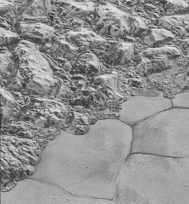
Pluto’s ‘badlands’ show where erosion and faulting have carved Pluto’s icy surface. Image credit: NASA
The New Horizons spacecraft has sent back stunning new images of Pluto showing the surface in the greatest detail available so far.
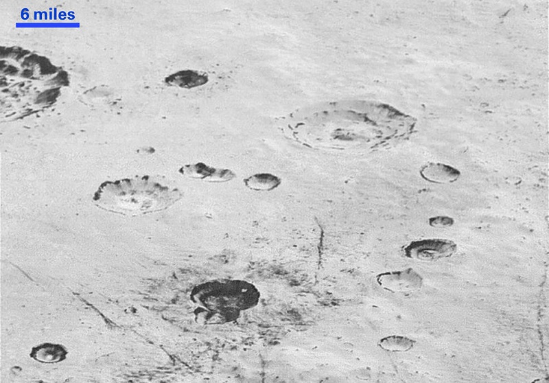
Images of Pluto’s icy plains show distinct layers inside craters, evidence of stratification. Image credit: NASA
New Horizons sends data back to Earth once a week. The latest close-up images were taken on July 14 by the Long Range Reconnaissance Imager (LORRI), about 15 minutes before the craft’s closest approach to Pluto. That meant the photos were taken from a range of 10,000 miles. They show a strip of land 50 miles wide, with resolutions of about 250 – 280 feet per pixel.
The images show how erosion and fault lines effect Pluto’s alien geology.
“Impact craters are nature’s drill rigs, and the new, highest-resolution pictures of the bigger craters seem to show that Pluto’s icy crust, at least in places, is distinctly layered,” William McKinnon, deputy lead of the New Horizons Geology, Geophysics and Imaging team from Washington University in St. Louis, said in a press release. “Looking into Pluto’s depths is looking back into geologic time, which will help us piece together Pluto’s geological history.”
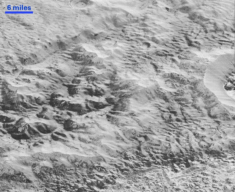
Another image of the ‘badlands’ region shows erosion. Image credit: NASA
“These new images give us a breathtaking, super-high resolution window into Pluto’s geology,” said New Horizons Principal Investigator Alan Stern, of the Southwest Research Institute (SwRI) in Boulder, Colo. “Nothing of this quality was available for Venus or Mars until decades after their first flybys; yet at Pluto we’re there already – down among the craters, mountains and ice fields – less than five months after flyby! The science we can do with these images is simply unbelievable.”
LORRI was operated in a different observing mode than usual in order to capture these shots. Instead of working in “point and shoot” mode, it took photographs every three seconds, at the same time as the Ralph/Multispectral Visual Imaging Camera (MVIC) scanned the surface.
The new images are six times more detailed than the Pluto map New Horizons also obtained.
“These close-up images, showing the diversity of terrain on Pluto, demonstrate the power of our robotic planetary explorers to return intriguing data to scientists back here on planet Earth,” said John Grunsfeld, former astronaut and associate administrator for NASA’s Science Mission Directorate. “New Horizons thrilled us during the July flyby with the first close images of Pluto, and as the spacecraft transmits the treasure trove of images in its onboard memory back to us, we continue to be amazed by what we see.”
Filed Under: Aerospace + defense


